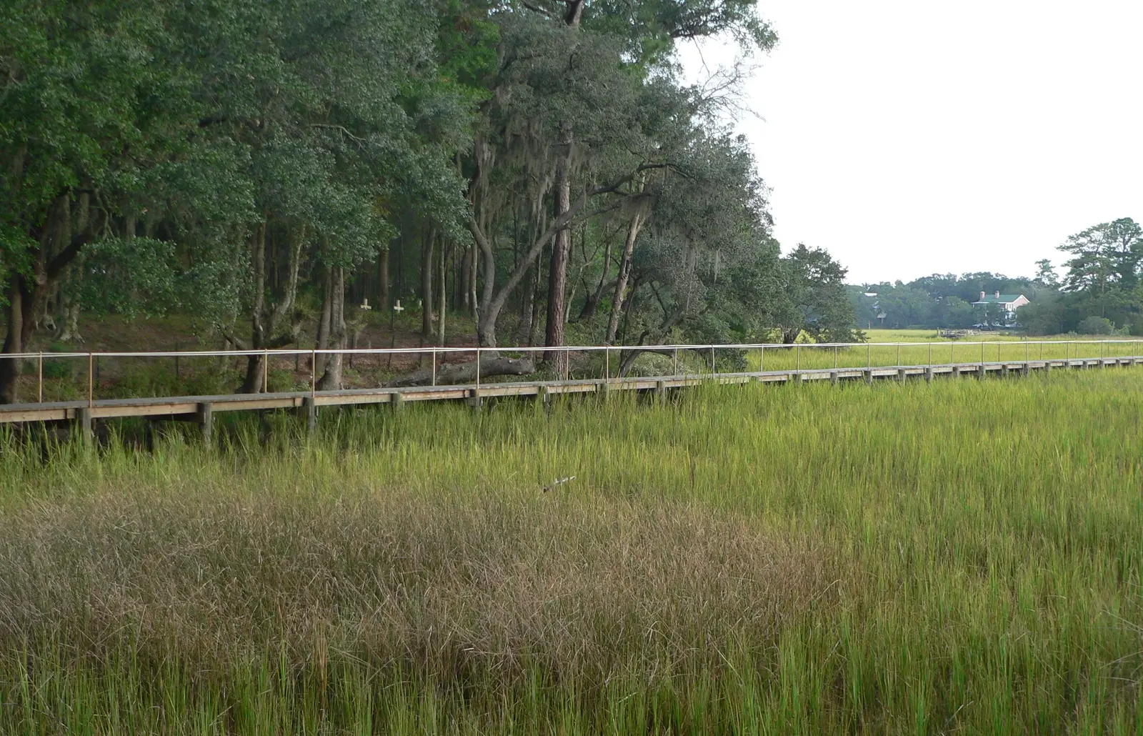
Remley's Point, with Scanlonville, sits on the Wando River north of U.S. 17 in ZIP code 29464, zoned for Beckham High. Typical value: $933,192 in Sept. 2026.
Last checked Oct. 16, 2026. Sources: the Town of Mount Pleasant’s Settlement Communities report, GIS map services (address points, subdivisions, parks) and facilities directory, Charleston County School District’s school lookup map, the South Carolina school report cards, Zillow Research and OpenStreetMap.
Remley’s Point is the point of land on the Wando River just north of U.S. 17, where the Ravenel Bridge comes ashore in Mount Pleasant. The town’s subdivision map names Remleys Point, and OpenStreetMap places Remleys Point, Scanlonville and Molasses Creek here. It is one of the smaller areas in this guide, with 1,157 addresses in the town’s address file, all in ZIP code 29464.
What this means for you
- Zoned high school: Lucy Garrett Beckham High, rated Excellent on its 2025 state report card, for every address we checked. Confirm yours with the district’s school lookup tool.
- Home value: $933,192 in ZIP code 29464 in September 2026, according to the Zillow Home Value Index.
- Nearest interstate exit: I-526 Exits 29 and 30, the U.S. 17 interchange, about 3.8 miles by road; downtown Charleston is across the Ravenel Bridge.
Part of our Mount Pleasant neighborhoods guide.
Where it is
For this guide Remley’s Point runs north of U.S. 17 and west of Mathis Ferry Road to the river, up to about Molasses Creek. The boundary lines are ours, drawn along those roads and the water. Mathis Ferry Road is the way in; the numbered avenues and streets of Scanlonville run off it toward the river.
The town’s Settlement Communities report tells the area’s history. Scanlonville was founded in 1868, when 100 freedmen who belonged to the Charleston Land Company, led by Robert L. Scanlon, bought 614 acres of the Remley Plantation at auction for $6,100. The land was platted in 1870 into 394 half-acre town lots, 111 vacant lots and 100 two-acre farm lots, with land set aside for a park and a cemetery. From the 1930s to the 1970s the waterfront held Riverside Beach and a music venue, White’s Paradise, that hosted Duke Ellington, Louis Armstrong and James Brown, the report says. The report counts Scanlonville among about a dozen historic African American settlement communities in and around the town.
Schools
We checked all 1,157 addresses against Charleston County School District’s attendance boundaries in its school lookup map (elementary zones for 2026-27, middle and high school zones for 2025-26).
| Level | School | Share of addresses | 2025 state rating |
|---|---|---|---|
| Elementary | James B. Edwards Elementary, 855 Von Kolnitz Road | 99% | Excellent |
| Middle | Moultrie Middle, 645 Coleman Blvd. | 100% | Excellent |
| High | Lucy Garrett Beckham High, 1560 Mathis Ferry Road | 100% | Excellent |
The remaining 1% of addresses, at the southern edge, were zoned for Mt. Pleasant Academy. Ratings are the overall ratings on the state’s 2025 report cards; Beckham High’s 2025 graduation rate was 95.5%. More in our schools guide.
Home values
The Zillow Home Value Index for ZIP code 29464 was $933,192 in September 2026, up 3.0% from $906,136 in September 2025. Zillow’s figure for Mount Pleasant as a whole was $871,681. The index is a modeled typical value for the middle third of homes, not a sale price, and 29464 covers far more than Remley’s Point. More in our home prices guide.
Parks and the river
From the town’s parks layer and facilities directory and Charleston County Parks:
- Remley’s Point boat landing, 80 Fifth Ave.: a free county landing on the Wando River with a courtesy dock and accessible parking.
- David Simmons Community Dock, at the Fourth Street end: a town dock named for a longtime Remley’s Point and Scanlonville community member, near the sites of Riverside Beach and White’s Paradise, the town says.
- Remley’s Point Community Center, 363 Sixth St., with a playground and a lighted basketball court.
- Memorial Waterfront Park, 99 Harry M. Hallman Jr. Blvd., at the foot of the Ravenel Bridge on the area’s southern edge, with the Mount Pleasant Pier.
More in our parks and trails guide.
Getting around
- Interstate: I-526 Exits 29 and 30, the U.S. 17 interchange, are about 3.8 miles by road from the David Simmons Community Dock; Exit 28, Long Point Road, is about 5.5 miles. Exit numbers are as mapped on OpenStreetMap.
- Town offices, 100 Ann Edwards Lane: about 1.3 miles.
- Charleston International Airport, 5500 International Blvd., North Charleston: about 16.6 miles, over the Ravenel Bridge.
- Bus: no CARTA route runs through the area. Route 41 (Coleman Blvd) stops at Memorial Waterfront Park and the Mount Pleasant Visitor Center, and Routes 40 and 41 stop on Houston Northcutt Boulevard at Ann Edwards Lane, according to CARTA’s maps and schedules.
- On foot or bike: Wonders’ Way, the walking and biking path across the Ravenel Bridge, starts on the Mount Pleasant side.
Distances are measured on the OpenStreetMap road network from the David Simmons Community Dock; they are distances, not drive times. More in our getting around guide.
Groceries and everyday stores
OpenStreetMap lists no supermarket or pharmacy inside Remley’s Point. The nearest are across U.S. 17 near the bridge: Harris Teeter, 920 Houston Northcutt Blvd.; Whole Foods Market, 923 Houston Northcutt Blvd.; Trader Joe’s, 401 Johnnie Dodds Blvd.; and Tidewater Pharmacy, 421 Johnnie Dodds Blvd. See our Shem Creek and Coleman Boulevard page.
Frequently asked questions
Where is Remley’s Point in Mount Pleasant?
On the Wando River just north of U.S. 17 and the Ravenel Bridge, west of Mathis Ferry Road. It includes the historic Scanlonville community, which freedmen bought from the Remley Plantation in 1868.
What schools serve Remley’s Point?
In Charleston County School District’s zones, 99% of the addresses we checked were zoned for James B. Edwards Elementary, and all of them for Moultrie Middle and Lucy Garrett Beckham High. All three were rated Excellent on their 2025 state report cards.
What is the typical home value in Remley’s Point?
Remley’s Point is in ZIP code 29464, where the Zillow Home Value Index was $933,192 in September 2026, up 3.0% from a year earlier. That figure covers the whole ZIP code.
Is there a boat ramp at Remley’s Point?
Yes. Charleston County runs a free public landing at Remley’s Point, 80 Fifth Ave., on the Wando River, with a courtesy dock and accessible parking. The town’s David Simmons Community Dock is nearby.
Have your say